
Welcome, to the Navarro River Watershed!
Navarro Watershed Overview
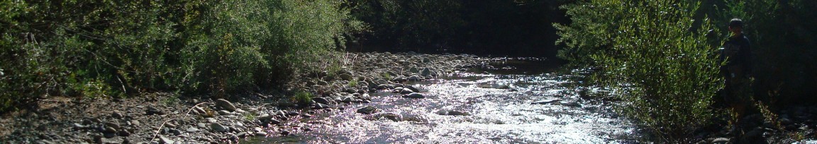
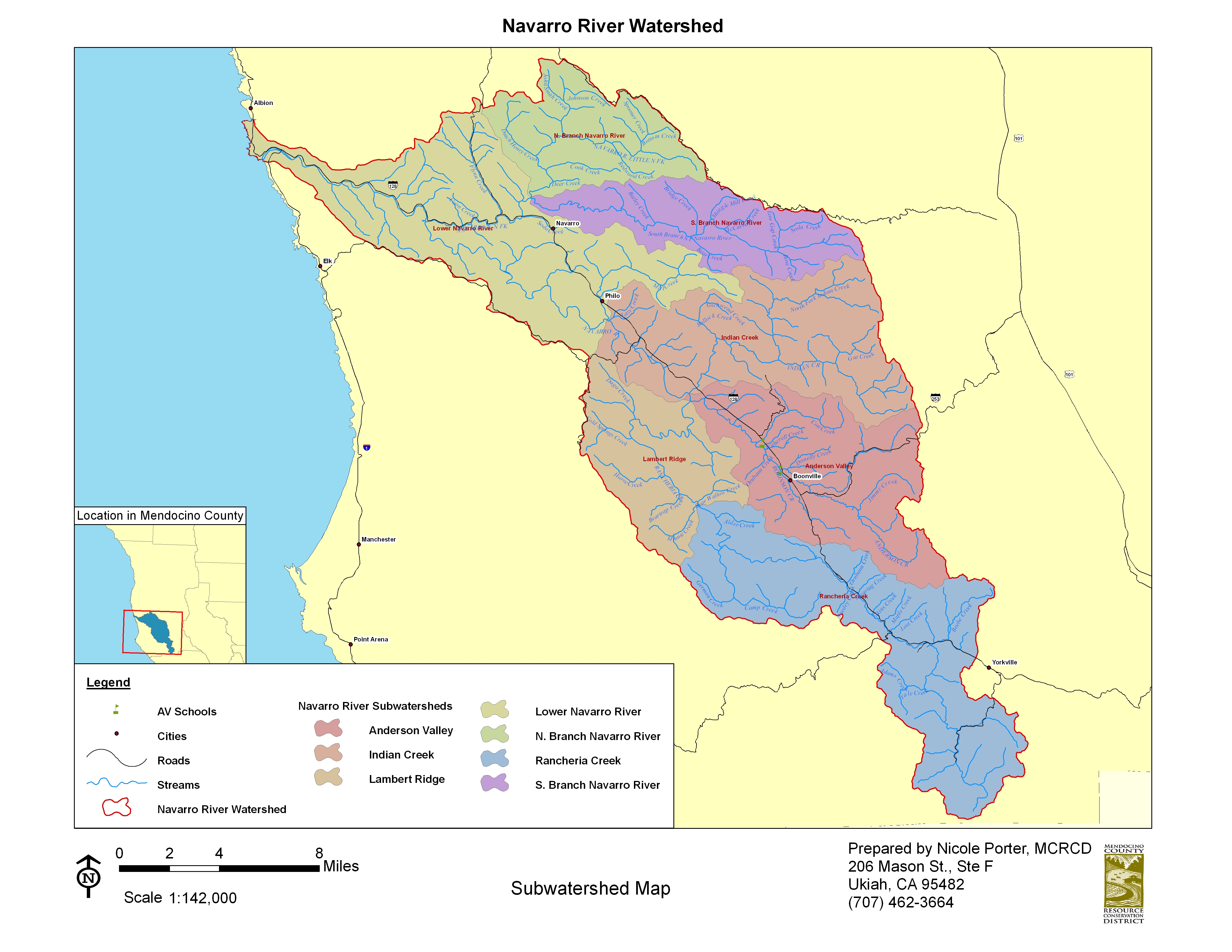
The Navarro River watershed is located in southern Mendocino County, approximately 120 miles north of San Francisco and 30 miles west of Ukiah. Encompassing 315 square miles, it is the largest coastal basin in Mendocino County. The watershed can be subdivided into 5 major drainage basins; beginning with the “top” of the watershed near the town of Yorkville with Rancheria Creek, Anderson Creek then enters into the system from Ukiah and Yorkville Highlands and flows through the Anderson Valley where it meets up with Indian Creek. In Philo the Rancheria (R) , Anderson (A), and Indian (I) creeks come together to form the Navarro River (N), easy to remember by spelling out the word “R-A-I-N“. From Philo the mainstem Navarro River continues until the last major sub-basin, the North Fork Navarro River joins the mainstem five miles from the Coast originating from Comptche and Flynn Creek area. From there the river flows into the Pacific Ocean. Population of the watershed is about 3,500 people, with most living in and around the towns of Boonville and Philo. Land-use in the watershed includes forestland (70%), rangeland (25%), and agriculture (5%) with a small percentage devoted to rural residential development. Since the mid-1800’s the Navarro River watershed has been logged for timber production, has provided grasslands for ranching, and agriculture taking place in the Valley soils and along the ridge tops.
Increasing pressure on natural resources continue as new permanent and part-time residents from the “greater Bay Area” engage in many of these land-use and development activities. Today, commercial timber harvesting, viticulture, orchards, grazing, and tourism are the principal economic enterprises. Although the above land-uses are the basis of the local economy and community, overtime they have had a significant impact on water quality and contributed to the decline of local Salmon and steelhead populations. Historically, the Navarro River watershed was considered to have high quality and extensive anadromous fish habitat supporting a productive coho salmon and steelhead trout fishery comparable to any basin in Mendocino County. However, commercial fishing has been in serious decline, with an estimated 3,000 fishing related jobs lost in the coastal Mendocino County region. Sport fishing for coho salmon in local streams has ceased. The geographic distribution of coho salmon has been shrinking, and the species is near extirpation from the watershed. Recognizing the wide-spread loss of coho salmon populations along the north central California coast, the National Marine Fisheries Service (under the federal Endangered Species Act), listed coho salmon as an endangered species in 2005. National Marine Fisheries Service (NMFS) also listed steelhead populations as a threatened species. In addition to the listing by NMFS, the State Water Resources Control Board (SWRCB) listed the Navarro River in2000, under Section 303(d) of the federal Clean Water Act, as an impaired water body whose beneficial uses are threatened due to sedimentation and high stream temperatures. ( Navarro Watershed Restoration Plan, 1998 Entrix)
Navarro Watershed Restoration Plan
the Navarro Watershed Restoration Plan was released in 1998, developed as a joint project of the Mendocino County Water Agency, the California State Coastal Conservation and the Anderson Valley Land Trust. It was Prepared by Entrix, Inc., Pacific Watershed Associates, Circuit Rider Productions, Inc., The Navarro Watershed Community Advisory Group, and Daniel T. Sicular, Ph.D. Navarro Watershed Restoration Plan (Entrix 1998)- PDF
Navarro Watershed Information Links
There has been a daily flow gauge located on the Mainstem Navarro River since 1950. You can access daily general watershed information, flow rates, historical flow data and information, as well as storm and future flow rate predictions by following the following links:
- Navarro River Flow Gauge- current conditions
- 7-Day Forecast for Boonville
- National Weather Service Advanced Hydrologic Prediction Service- Navarro River
- EPA Surf Your Watershed- Navarro River
- Klamath River Information Systems (KRIS)- Navarro River